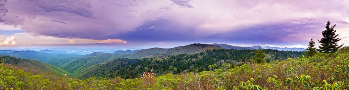
Conserving Mountain Ecosystems
Featured Programs
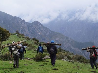
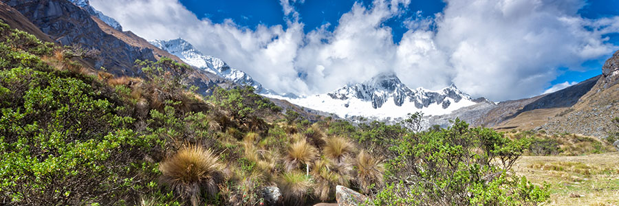
Ecosystem-based Adaptation in Nor Yauyos-Cochas Landscape Reserve
Using an innovative approach called Ecosystem-based Adaptation, the Instituto de Montaña (IdM) is helping communities in the Nor Yauyos-Cochas Landscape Reserve above Lima, Peru adapt to anticipated climate change impacts such as water scarcity. By working together, we managed to restore abandoned, water management techniques and infrastructure that dated back to the time of the Incas. These traditional methods were used to increase water infiltration in alpine hills, replenishing groundwater stores. After restoring these ancient structures, IdM assessed their hydrologic impact and conducted a cost-benefit analysis of various investments for maintaining these highland water resources. These measures are improving irrigation to rangeland and agricultural land. The availability of drinking water has also increased for both local and downstream communities. Learn more.
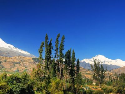
High Andean Wetlands Restoration Project
In partnership with the Huascarán National Park of Peru and local land-user committees, the Instituto de Montaña (IdM) led a multidisciplinary effort to restore the high mountain wetlands of the Cordillera Blanca. When healthy, these landscapes are highly valuable as buffers against flooding and extended dry periods, serving as natural filters for fresh drinking water, and havens for a rich and specialized array of plants and animals. Many wetlands are being degraded due to changes in climate and pressures from mining and livestock grazing. By working closely with park authorities and local communities, IdM has promoted science-based decision making to secure healthy wetlands and protect livelihoods for the communities that rely upon them. We are grateful to the United States Forest Service for funding this project.
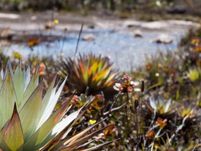
Protecting the Páramo
The Páramo, an alpine wetlands/grasslands ecosystem extending from Peru to Venezuela, harbors tremendous biodiversity and is a critically important water source for Peru’s mountain communities and heavily populated western lowlands. Having developed the first detailed maps of the Páramo and documented its importance as a source of water to the valleys and coast, the Instituto de Montaña (IdM) has worked with the Peruvian government to establish a protected area covering 400,000 hectares to conserve this valuable and endangered ecosystem. We have also worked with highland farmers to reduce grazing pressure on the Páramo, bringing together highland and lowland communities to bring awareness to its ecological importance and ensure cooperation for its protection. In the Piura region of northern Peru, we helped five municipalities form a commonwealth to protect the Páramo and promote the sustainable development of the communities living below this alpine ecosystem. IdM has sponsored agricultural and craft livelihood opportunities in areas adjacent to the Páramo to reduce the pressure on Páramo lands. Peru’s Ministry of Culture has nominated the Páramo ecosystem in Peru to be designated as a national cultural landscape which will help preserve indigenous healing traditions that take place at Páramo lakes.
Past Programs
Peaks to Coast: Building Climate Change Awareness & Resilience in the Ancash and Piura Watersheds of Northern Peru
The Peaks to Coast program’s objective was to strengthen the people of Peru‘s ability to respond to climate change. The Mountain Institute worked to develop relationships between scientists, policy makers, and community governments. This program also helped communities adapt to a changing climate, in both up-stream and down-stream regions, by implementing resilience strategies.
Instituto de Montaña (TMI) received $1.2 million dollars to implement this project over three years, beginning in 2009. TMI developed cooperative projects with communities in the upper sections of the two major river basins of northwestern Peru, the Santa and Chira rivers in the Ancash and Piura Regions. As a function of the program, community groups designed conservation plans for grassland and forest restoration. These conserved areas act as buffers to effects of climate change, such as swelling and flooding of the Santa and Chira rivers. In partnership with local municipalities, the project supported the development of climate change adaptation plans. The project also fostered cooperation of highland communities and municipalities with lowland groups that depend on mountain water for their agriculture-dependent economies. Because these economies are heavily dependent on agricultural products, and because the products cannot be grown without reliable access to water, these lowland groups were especially invested in the conservation partnership.
In February-March of 2010, the first Climate Change Vulnerability and Adaptation (V&A) training was conducted in Peru by USAID, International Resources Group (IRG). V&A is a six-step method designed to encourage stakeholders to identify their vulnerabilities (e.g., water supply) as well as identify adaptive strategies to lessen or eliminate the threats imposed by climate change. TMI staff and NGO/Governmental stakeholders were trained by USAID and IRG in Huaraz in preparation for the community training in Macara, a nearby village. The team then departed for the coastal city of Chimbote and conducted a stakeholder training workshop there on February 19. TMI, IRG, and USAID/Washington representatives debriefed USAID/Peru on February 23. USAID was pleased with the training and called “Peaks to Coast” its flagship project. Geohydrologist Daene McKinney and Alton Byers then completed a 5 day water supply and stressor study from the Cordillera Blanca to major irrigation schemes on the coast, interviewing farmers, government officials, glacial lake control specialists, power plant personnel, and irrigation projects.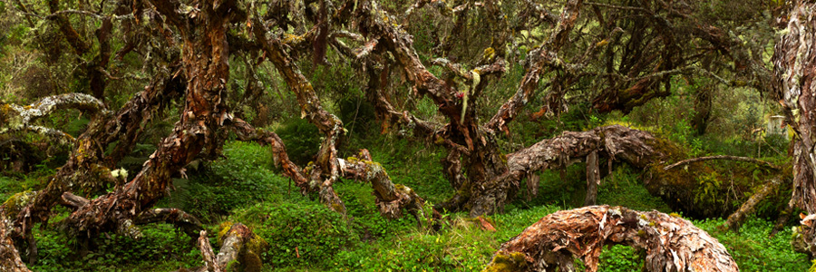
Southern Conchucos Polylepis Forest
Targeting the last remnants of queñual (Polylepis spp) cloud forests in Ancash Region, this initiative was launched on a small scale in 2000 and scaled up through a partnership with Conservation International and the Ancash Association. It supported mountain communities interested in protecting and restoring these unique high alpine forests that provide a habitat to several endemic plant, animal and bird species. Restoration of these forests contributed to the health of the ecosystem and was linked to the creation of livelihood opportunities that reduce local pressure on forests. It is estimated that protecting these remnant forests provided sanctuary to approximately 55% of all endemic bird species in the Andes of Peru and Bolivia and protected 67% of all birds in danger of extension in this vast region.Achievements:- Twelve forest conservation agreements were established with communities in Ancash to support restoration and protection of these forest remnants. The community of Huasta, which holds the largest Polylepis forest tracks in Ancash region outside of Huascaran National Park joined the project and initiated restoration of these forests.
- TMI completed a diagnostic study and community consultation process to develop a Forestry Conservation Strategy in the highland regions of Piura Department (Carmen de la Frontera District). These native forests include large tracks of Polylepis forests. The study included a technical assessment of the potential for carbon sequestration through Reducing Emissions from Deforestation and Forest Degradation (REDD) and Clean Development Mechanisms (CDM).
- The project included a comprehensive program of community workshops to assess stakeholder interests in projects to reverse environmental degradation.
- A menu of potential community forestry projects was developed in this region that is the headwaters of a major new irrigation project in coastal Peru.
High Mountains Adaptation Partnership (HiMAP)
The Mountain Institute played a leading role in the High Mountains Adaptation Partnership (HiMAP) – a community of practice focused on high mountain glacial watersheds. HiMAP’s focus was on strengthening the scientific, social and institutional capacity for climate change adaptation, resilient development and disaster risk mitigation and management (especially for dangerous glacial lakes) in high mountain regions of Peru and Nepal. HiMAP accomplish its goals through:—building knowledge and capacity, developing adaptation plans, increasing resilience, and informing climate-smart development at the local level, particularly for mountain communities —building stronger institutions and fostering the next generation of mountain-scientists and development practitioners through competitive small grants and mentoring; and —building a global community of practice for high mountain glacial watershed technical analysis and sharing of knowledge and lessons learned.HiMAP successfully combined science and local knowledge to increase global awareness of the critical importance of high mountain watersheds, particularly in the context of climate change, highland-lowland interactions, and ecosystem services. HiMAP was supported by funding from USAID.To learn more about HiMAP visit the website.
Alpine Conservation & Restoration Project (Himalayan & Andean Programs—Nepal, Peru, and Patagonia)
This project protected and restored alpine ecosystems. These ecosystems had been damaged by unregulated adventure tourism in Nepal (Mt. Everest National Park, Makalu-Barun National Park), Peru (Huascaran National Park), and Patagonia (Glaciers National Park). The impacts of the alpine restoration initiative to date included saving 500,000 km of fragile alpine shrub juniper per year. This rare species of juniper was formerly used as fuel by tourist lodges. Other successes included restoring high altitude ecosystems through better local stewardship and mobilizing the climbing and trekking communities worldwide to become better high altitude conservationists, and to donate their time and financial resources to protecting the landscape.
In 2009, an 80% increase in grass/herbaceous cover was measured at TMI‘s project site in the Huascaran National Park. This site had been decimated by cattle grazing, and was re-planted successfully when TMI helped villagers move cattle to improved pasture locations at lower elevations to avoid overgrazing.